Calling All Outdoor Enthusiasts Pennsylvania Statewide Outdoor Recreation Map Will Elevate Your Adventure Plans
Calling all outdoor recreation enthusiasts and nature lovers: the all-new Purple Lizard Pennsylvania Statewide Outdoor Recreation Map has just launched!
From the Centre of Outdoor Adventure – Happy Valley, Pennsylvania - The Happy Valley Adventure Bureau celebrates with Purple Lizard Maps, the Pennsylvania Environmental Council, and the Pennsylvania Parks and Forests Foundation, and with all outdoors enthusiasts, on the launch of the all-new Purple Lizard Pennsylvania Statewide Outdoor Recreation Map! Explore more of the Happy Valley Outdoors here.
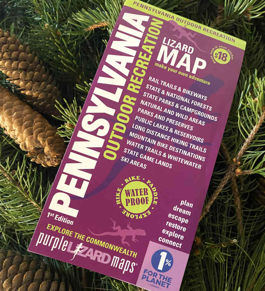
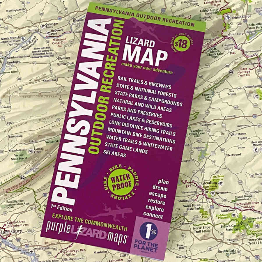
Curated especially for outdoor enthusiasts, this first of its kind big-picture statewide recreation planning tool showcases the extraordinary wealth of Pennsylvania outdoor recreation assets including 124 State Parks, 20 State Forests, 114 Rail Trails and Bikeways, 53 Mountain Bike Destinations, 30 Long Distance Hiking Trails, 20 Ski Areas and 17 Water Trails and Whitewater Destinations. It also features Pennsylvania State and National Forests, Recreation Areas, Wild and Natural Areas, State Game Lands, and public lakes managed by the Pennsylvania Fish and Boat Commission and Army Corps of Engineers.
Nathan Reigner, PhD, Director of Pennsylvania’s new state Office of Outdoor Recreation, commented on the new publication, “Pennsylvania is an outdoor state. We know this to be true from the data on outdoor recreation’s tremendous economic impact and we feel it in our lives. Now we can see it for ourselves in this first of a kind map - we can see the way our communities are connected by trails and every corner of our Commonwealth is graced by outstanding parks, forests, and rivers.”

Michael Hermann, Founder Purple Lizard Maps.
The PA Outdoor Recreation Statewide ‘Lizard Map’
The map was designed by Purple Lizard Maps, a Pennsylvania based recreational cartography company founded by Michael Hermann that is known for producing high quality, waterproof, beautifully designed trail maps of outdoor recreation destinations throughout the Mid-Atlantic region. The 18th map in Purple Lizard's collection, the Pennsylvania Statewide Outdoor Recreation Lizard Map is their first statewide map designed to serve as a big-picture statewide gateway.
Hermann commented,"The best maps don't just guide people; they inspire a deeper connection with place and spark the imagination for future adventures. This map is both a tribute to an extraordinary outdoor landscape and a vision of what’s possible in Pennsylvania outdoor recreation. In a time of fixation on 2-inch screens that limit our ability to see the full landscape, it connects the dots across the abundance of outdoor recreation options in the Commonwealth.”
A Breakthrough Partnership and a Call to Conservation and Stewardship
To bring this pioneering project to life, Purple Lizard Maps has partnered with the Pennsylvania Environmental Council (PEC), a leading Pennsylvania environmental advocacy and stewardship organization. PEC’s support was key to helping highlight Pennsylvania's rich conservation history and the
map also serves as a call to action, inviting users to get involved in stewardship of Pennsylvania's public lands.
Brett Hollern, PEC’s Vice President for Western Pennsylvania including trails and outdoor recreation, commented on the importance of the map for the state, “This map is a great introduction to the many outdoor recreation opportunities that abound in Pennsylvania. The Commonwealth offers 84,000 miles of rivers and streams; 4,500,000 acres of public land, thousands of miles of trails, and wonderfully varied terrain and opportunity. Not only is this important to those looking to get outside – outdoor recreation pumps over $17 Billion into PA’s economy every year and supports over 164,000 jobs. PEC is thrilled to partner with Purple Lizard Maps to bring this great resource to residents and visitors alike.”
The Pennsylvania Parks and Forests Foundation, another long standing partner of Purple Lizard, provided additional support for publication.
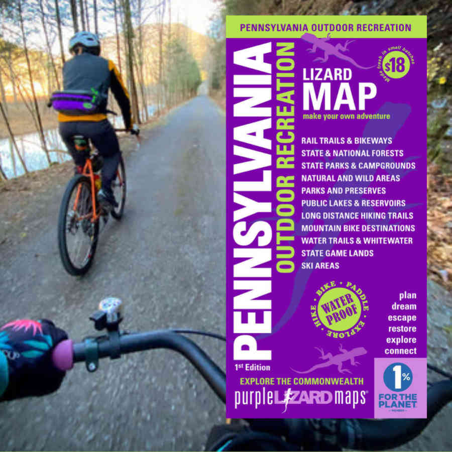
Map image on Pine Creek Rail Trail.
Pennsylvania's Outdoor Playground: Stats and Economic Impact
Pennsylvania offers a vast outdoor playground - with over 4.5 million acres of accessible public land. Including 2.2 million acres of State Forest, 300,000 acres of State Parks, 1.5 million acres of State Game Lands, 500,000 acres of the Allegheny National Forest plus many county and town parks. The outdoor recreation activity associated with public land is an important part of the State’s economy, contributing more than $17 billion to Pennsylvania’s GDP in 2021 according to the US Bureau of Economic Analysis, making it the 8th largest outdoor recreation economy in the nation.
What’s the deal with those Little Purple Lizards? All Lizard Maps feature little Purple Lizards throughout. These represent noteworthy spots, interesting tidbits, and local insights that make each map a treasure trove of information and adventure.
Available Now: The Pennsylvania Statewide Outdoor Recreation Lizard Map is available for purchase through PurpleLizard.com and at Purple Lizard Maps Authorized Dealers throughout the Mid-Atlantic region.