Seven Best Hikes Near Penn State University
One of the best ways to enjoy the outdoors in Happy Valley is by taking a scenic hike to a mountain vista or by a bubbling creek. These popular hiking trails near Penn State will take your breath away - in more ways than one!
There’s nothing better than heading out to the lush state parks or state forests in Happy Valley, Pennsylvania, for a hike to get some exercise and clear your mind.
Whether you want an iconic trail or to get off the beaten path, there is something for you here. The Happy Valley area also boasts a nice variety of mountain views, lakes, and gurgling creeks.
Trails can be rocky in the area so be sure to pack your hiking boots and trekking poles if you need them. Especially if you’ll be trying some of the difficult trails!
Whether you’re just heading out for a leisurely stroll or want a trail that will get your blood pumping, check out a few of these hikes near Penn State.
"There’s nothing better than heading out to the lush state parks or state forests in Happy Valley, Pennsylvania, for a hike to get some exercise and clear your mind"
- Anna Cook
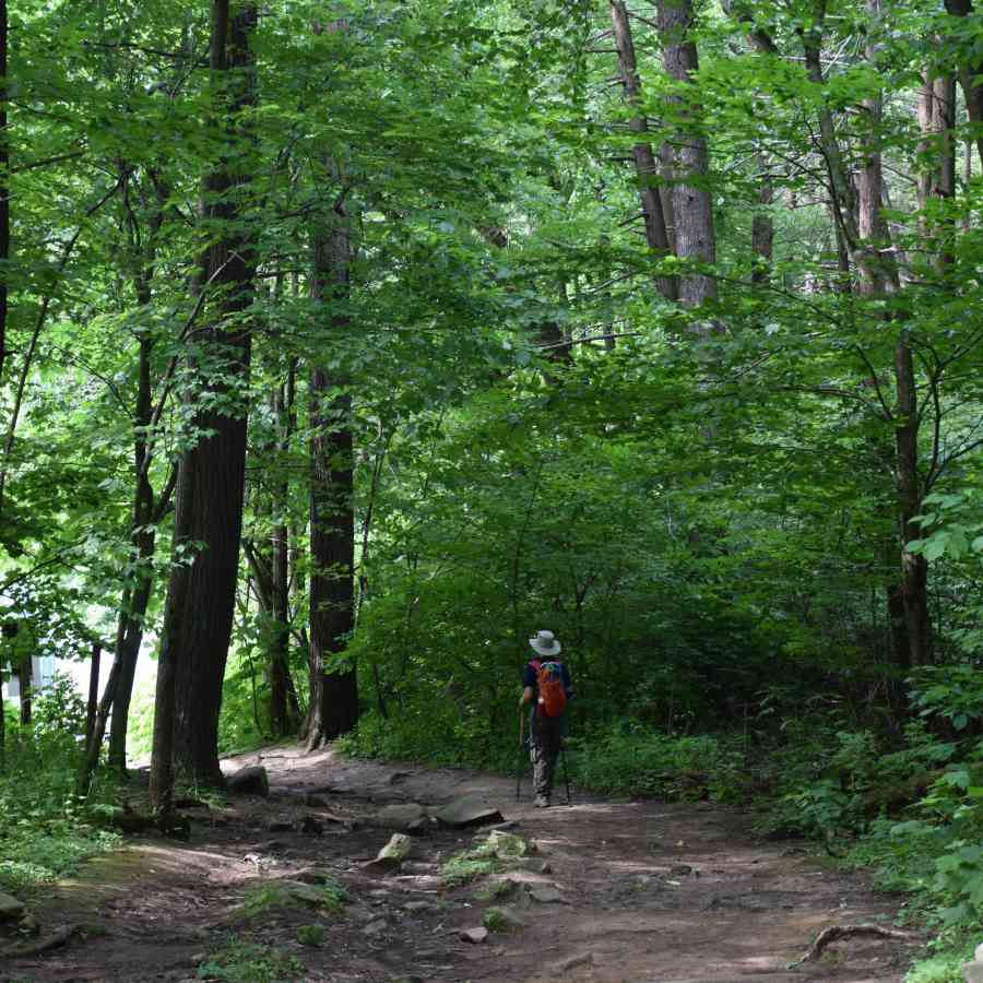
Mount Nittany Loop
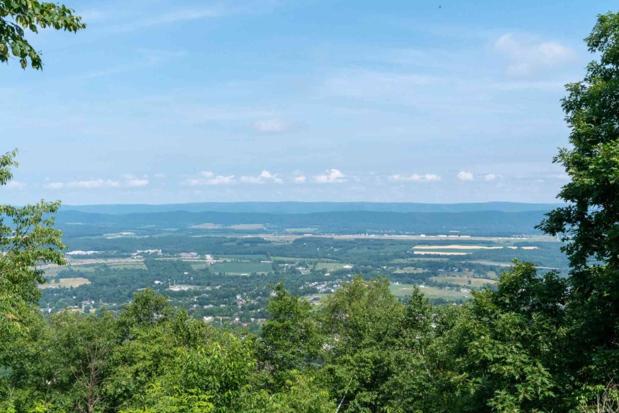
Probably the most iconic hike near Penn State is the Mount Nittany Loop which, of course, is on Mount Nittany. This is the mountain you’ll see on ESPN when they cover the Penn State Games.
The trailhead is less than ten minutes from campus and you’ll want to go early - especially on a weekend. The parking lot can fill up quickly.
This may be one of the most popular trails, but it is definitely not the easiest. It’s rated as moderate/strenuous and in the first 0.5-mile you will gain 650 feet of elevation.
Views from the mountains are fantastic though and well worth the climb. The most well-known overlook is the Mike Lynch Overlook and many people hike up the White Trail just to visit this one and then come back down. This is a 1.2-mile hike.
The Mike Lynch Overlook gives you a birds-eye view of campus, Beaver Stadium, Bryce Jordan Center, and the town of State College.
Options for trail routes include the White Trail and the Blue Trail. The White is a total of 3.5-miles round trip while the Blue is a 4.6-mile round trip hike. The Blue Blaze Trail will take you to more of the scenic overlooks.
Once you make it past the initial 0.5-mile and that elevation gain, the trail flattens out on top of the mountain. The other overlooks are quieter and a great picnic spot!
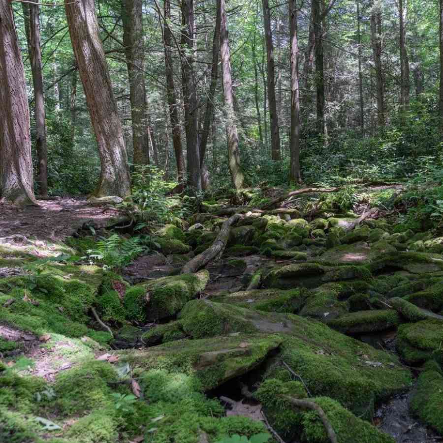
Shingletown Gap
The Shingletown Gap parking area is about 10 minutes from Penn State and a very peaceful spot for a hike with a “make your own adventure” type trail.
You’ll park at the end of Mountain Road at the base of Little Shingletown Trail. There is very limited parking so if you want to visit on a weekend, you may want to have a backup plan.
A great hike to do is the Lower Trail which follows the beautiful Roaring Run and makes a small loop at the top so you hike back the same way you came. You’ll want to take a map with you because there are multiple trail spurs that you could take.
Lower Trail also meets up with the Spring Trail, Bald Knob Ridge, and the Sand Trail over to Little Shingletown Trail. The Mist Trail also starts from the Shingletown Parking area. This is why a map comes in handy!
If you choose to take just the Lower Trail, the distance will be 5.3-miles with 597 ft of elevation gain. It is rated as moderate.
The trail is wooded and as I mentioned, follows Roaring Run. This is a rocky, moss-covered stream that makes it one of the most beautiful settings for a hike near State College.
There are also beautiful rhododendrons along the path that typically bloom in early July.
- Photo taken by Anna Cook
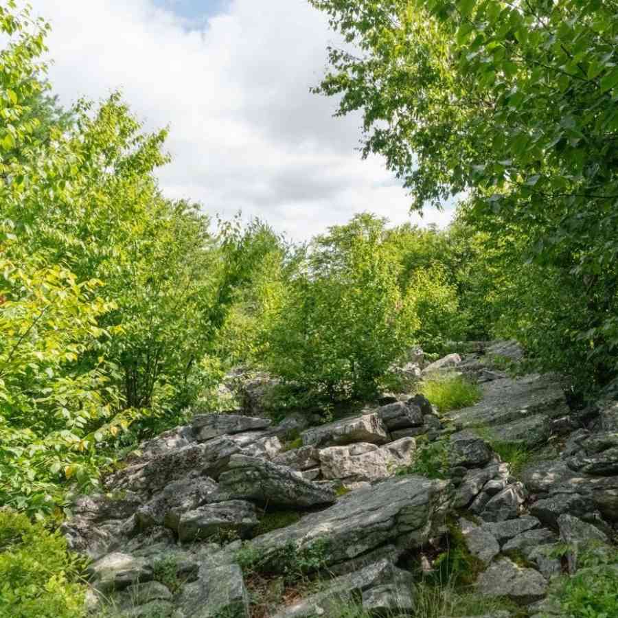
Greenshot Trail to Bald Knob Ridge
If you’re looking for a nice workout that doesn’t take too long and offers a nice view, then check out Bald Knob Ridge. There are multiple different ways that you can reach this trail - one is even from the Shingletown Gap parking area.
The quickest way to reach the Bald Knob Trail though, is from the pull-off on Laurel Run Road. The coordinates for the pull-off are 40.75556,-77.76499 and it’s very easy to miss! If you are coming up the mountain from Tussey Mountain Ski and Recreation, then it will be on your right.
This is where you’ll find the trailheads for Greenshot and Bald Knob Ridge Trails. I loved taking the Greenshot Trail up, then catching a short part of the Spring Trail, and then taking Bald Knob Ridge Trail down.
This one is really stunning in the fall when all the blueberry bushes turn fiery red. Of course, in the summer these bushes could provide a nice snack!
The trail is primarily wooded and leads up to a small vista at Bald Knob. The length is approximately 2.3 miles with around 580 ft of elevation gain.
- Photo taken by Anna Cook
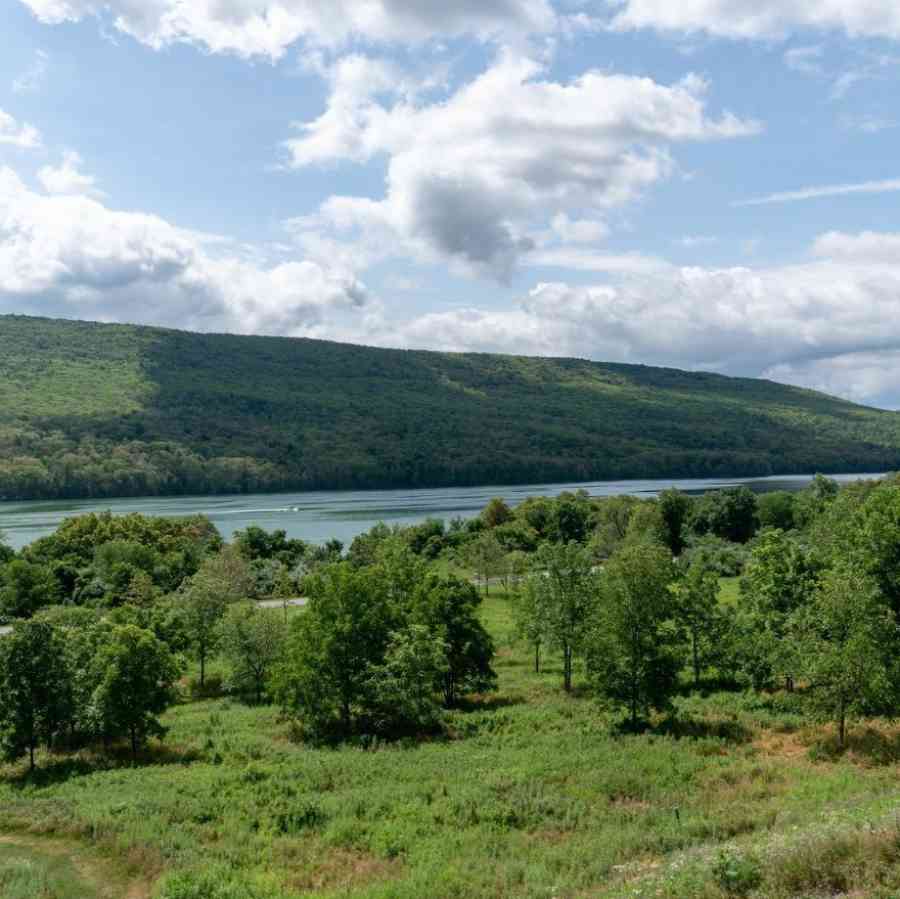
Colyer Lake
For a leisurely stroll around the water, head about 15 minutes east for Colyer Lake. Pro Tip: Don’t put “Colyer Lake” in your GPS! That will take you to private property.
There are two parking lots around Colyer Lake and both allow you to access the trail. One is located on the north side of the lake and the other is on the south side.
The entire loop is 2.6-miles but it is easy as there is only 131 ft of elevation gain. You won’t find many obstacles here as the path is wide and well-worn. Views of the lake around the trail are what keep people coming back!
In the spring and early summer, you can find beautiful wildflowers and the fall foliage is a sight to see. Just note that in the summer you’ll likely want to bring bug spray.
If you like to kayak or paddle board then bring your gear and you can combine a paddle and a hike!
- Photo taken by Anna Cook
Allegheny Front Trail
The entire Allegheny Front Trail is approximately 41.5 miles long so how far it is from Penn State depends on which access point you visit. If you access the trail from Black Moshannon State Park, it takes about 30 minutes to get there.
If you are a backpacker, then this is the perfect backpacking trail in the area for you! However, you can also do section hikes along the trail too.
One of the most popular spots to hike to are Ralph’s Majestic Vista and Ralph’s Pretty Good View.
You can hike to these viewpoints either from the parking area on Beaver Road or if you need a shorter hike then you can park where the trail intersects Underwood Road (approximate).
There is a parking area with a trail connector where Shirks Road intersects Beaver Road. This makes for a lengthy hike so be prepared!
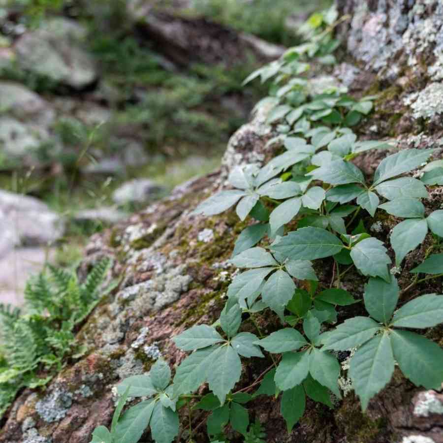
The hike is wooded and peaceful and you’ll see a large variety of plants and trees along the way to the vista. In a few parts, ferns blanket the ground and make you feel like part of a movie scene!
There are also plenty of trails to explore in Black Moshannon State Park if you would rather do a shorter hike.
- Photo taken by Anna Cook
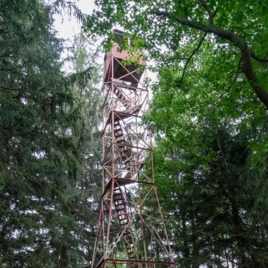
Little Flat Fire Tower
Another great hiking outing in Rothrock State Forest is from Keith Spring to Little Flat Fire Tower via the Mid State Trail. Note that this is a point to point hike so you would need to set up a shuttle system.
The drive to Keith Spring from Penn State is about 40 minutes and half of that will be on gravel roads through Rothrock. You can leave one vehicle at Skyline Trail Parking and another at Keith Spring.
There is not a lot of room at either of these trailheads so make sure your vehicle is not blocking the road and is fully pulled off to the side. Have a backup plan in case too many cars are already there.
This route will be approximately 5 miles and is considered moderate. It is very rocky so bring sturdy shoes and make sure you pack a map!
There are a few different points of interest, Keith Spring is a neat place to start and you pass Indian Wells soon after. This is a rock field that you cross with beautiful views of the surrounding mountains and overlooks Bear Meadows Natural Area.
You’ll follow the ridgeline along the Mid State Trail until you reach the Little Flat Fire Tower. You can’t climb the tower but it is neat to see!
- Photo taken by Anna Cook
Take a drive to the Raystown Lake Region of Pennsylvania:
This one is the furthest hike away from “base camp” in Happy Valley, but it is absolutely worth the drive. It is near Mt Union, Pennsylvania so it takes about an hour to get to the trailhead located along Route 22. The trailhead is a large gravel lot but this is one of the most popular hikes in the area so get there early on weekends!
The stairs portion is just under half a mile but you gain a whopping 843 ft in elevation over that distance. While AllTrails rates this as moderate, many would consider the route strenuous.
Once you are at the top of the stairs - there are actually 1,037 instead of 1,000 - you can take a right and go out to a few different overlooks or make a left and head to Dinkey Shed and the Mapleton Overlook.
These stairs were constructed back around 1936 as a way for men who worked in the Ledge Quarry to commute to work every day. I truly cannot believe how tough these men were to do this just to make it to work and back home!
Anna is a travel blogger and photographer at Stuck On The Go where she loves writing about outdoor adventure and small town USA. She created her blog to help busy people incorporate more adventures into their lives and inspire them to try new things - even if it's scary. She is based in North Carolina with her husband and German Shepherd who often tag along on weekend trips but she's known to take off on long solo road trips often.